Distribution Atlas of Vascular Plants of Austria
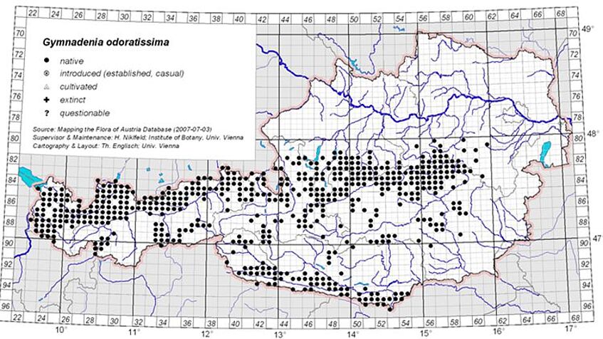
Distribution map of Gymnadenia odoratissima in Austria
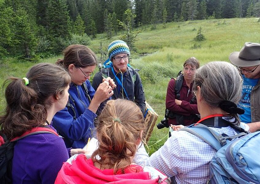
Field campaign (photo: C. Pachschwöll)
Distribution Atlas of Vascular Plants of Austria
Reliable and detailed maps of species distributions provide the basis for a broad spectrum of biological, ecological, geographical, and conservational issues. To create the necessary fundamental data and to make them available in distribution atlases and in computerized databases has become, during the last decades, the objective of international, national and regional botanical and zoological mapping schemes throughout Europe and beyond.
For Austria, our Research Group is acting as the national center for the project "Floristic Mapping of Austria", initiated by F. Ehrendorfer in 1963 and effectively started in 1967 within a Central European international framework. While cooperating with regional institutions, working groups and field botanists in the Austrian federal states, we provide methodical outlines and working tools, execute extensive fieldwork throughout many parts of Austria (with the aim of attaining an even and dense country-wide data coverage), advise voluntary collaborators, examine and revise obtained field-records, extract complementary data from botanical literature and herbaria, and establish and maintain the mapping database.
Our database contains about 1 800 000 Austrian records, each corresponding to one floristic observation, complemented by about 130 000 records from neighboring territories. The vast majority of data result from field records obtained during the mapping project. The average number of taxa recorded for each of the c. 2650 Austrian grid cells (quadrants [Quadranten]: 5' longitude × 3' latitude, equaling approximately 6.3 × 5.5 km: grid can be downloaded as kmz-file or shape-file for Google Earth and GIS applications, respectively) is about 500 taxa, each grid cell having been investigated during field trips. Several mapping campaigns have been carried in neighboring countries, most prominently in the Autonomous Province of Bozen/Bolzano (South Tyrol) in Italy (plant and animal distribution maps for this region are available here). Ongoing and imminent work is directed towards further improvement of the database, e.g. by inclusion of the main bulk of available literature records.
The results of Floristic Mapping of Austria are regularly incorporated into the all–European but less detailed Atlas Florae Europaeae, which is published in instalments according to a taxonomic sequence. In the Helsinki–based international editorial committee, H. Niklfeld is acting as advisory member, and as the regional contributor for Austria. Distribution data have also substantially contributed to projects such as "Spatial and Structural Problems of the Alpine Region" (Raumalp) or "Tracking Surrogates for Intraspecific Diversity" (IntraBioDiv).
Selected Publications
- Niklfeld H (1997) Mapping the flora of Austria and the eastern Alps. Revue Valdôtaine d'histoire naturelle 51 Suppl.: 53–62
- Walter J, Essl F, Niklfeld H, Fischer MA (2002) Gefäßpflanzen. Pp 76–173 in: Essl F, Rabitsch W (eds) Neobiota in Österreich. Wien, Umweltbundesamt
- Englisch Th, Essl F, Niklfeld H, Schratt-Ehrendorfer L, Walter J (2005) Neophyten in Österreich - Quelle oder Bedrohung des Artenreichtums? Pp 36–37 in: Borsdorf A (ed) Das neue Bild Österreichs. Strukturen und Entwicklungen im Alpenraum und in den Vorländern. Wien, Verlag der Österreichischen Akademie der Wissenschaften
- Moser D, Dullinger S, Englisch Th, Niklfeld H, Plutzar C, Sauberer N, Zechmeister HG, Grabherr G (2005) Environmental determinants of vascular plant species richness in the Austrian Alps. Journal of Biogeography 32: 1117–1127
- Niklfeld H (2013) Arealmuster von Pflanzen der Xerothermrasen und ihrer Kontaktgesellschaften im Raum von Wien (Österreich). Pp 39–42 in: Steppenlebensräume Europas — Gefährdung, Erhaltungsmaßnahmen und Schutz. Erfurt: Thüringer Ministerium für Landwirtschaft, Forsten, Umwelt und Naturschutz.